While New Orleans has put a lot of focus on historical preservation, change inevitably happens. Thinking the project would be fun, educational and eyebrow-raising to look back at some archive photos taken from above the skyline, local photojournalist Megan Mackel took on a project to do exactly that. Here’s what she captured.
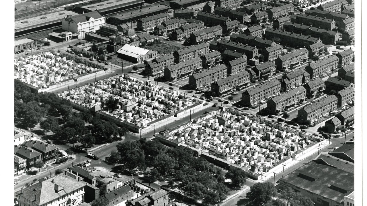
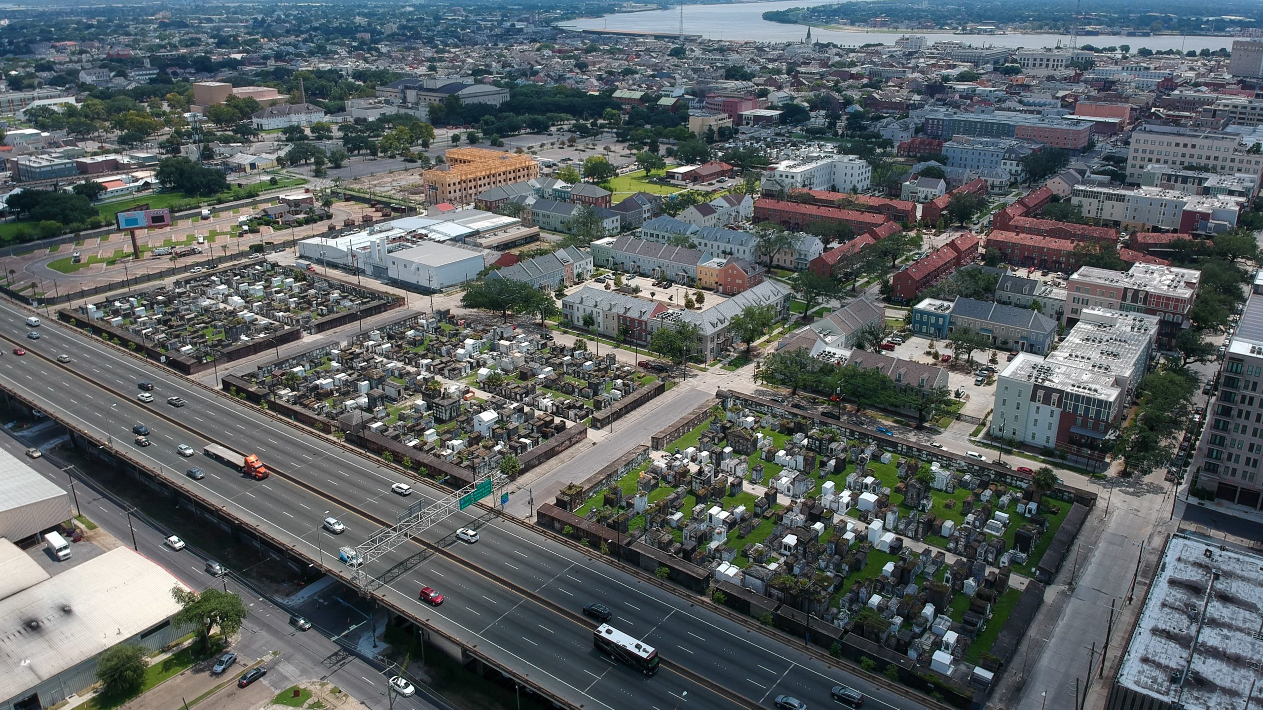
Iberville Housing Development, North Claiborne Avenue
This pair of photographs highlight the change not only in the Iberville Housing Development, but also in North Claiborne Avenue before and after the interstate. The archive photograph shows this New Orleans housing project as seen in 1948 and today the neighborhood has been developed into the Bienville Basin Apartments. The center of the images shows St. Louis Cemeteries No. 1 and No. 2. The Interstate 10 Claiborne Overpass is at the bottom of the modern-day photo, where in 1948, the same corridor can be seen before the interstate when the area was rich in local businesses and mature trees.
1948
2020
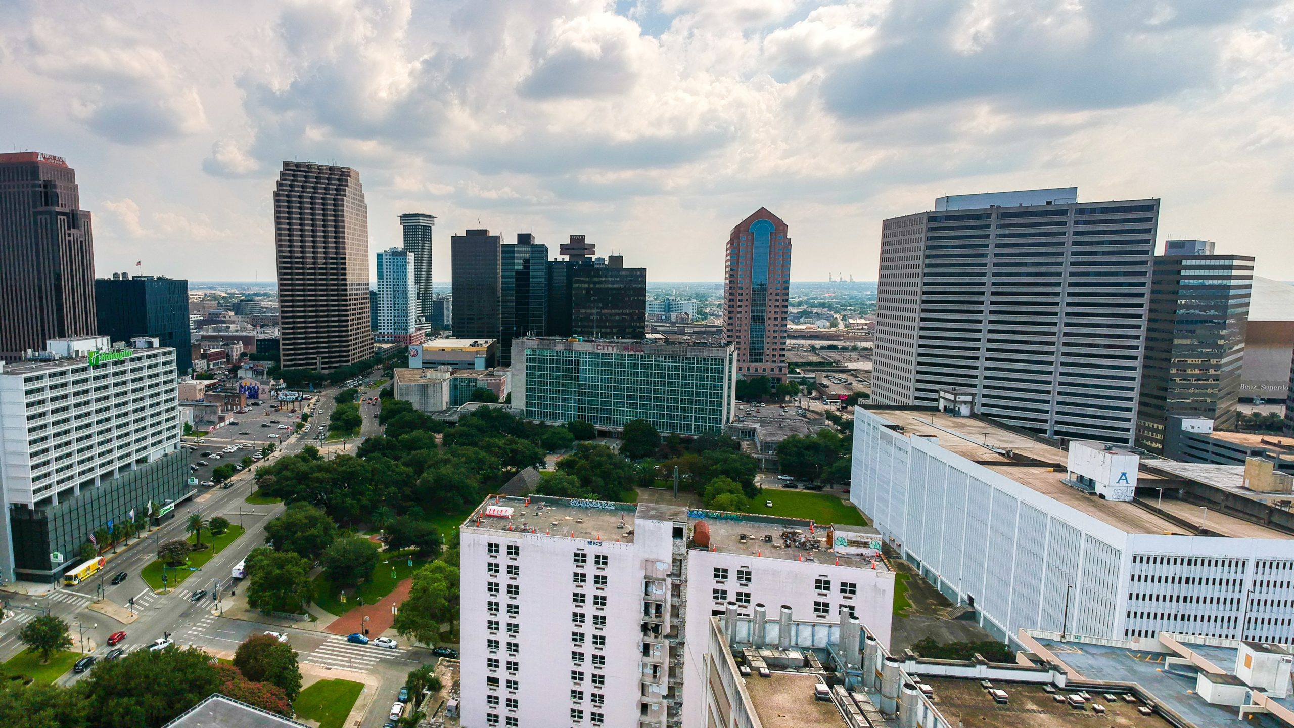
City Hall
In the 1950s this area was developed as a civic center with City Hall, Duncan Plaza, a library, and other government facilities. This 1959 archival photograph shows the early days of this development.
1959
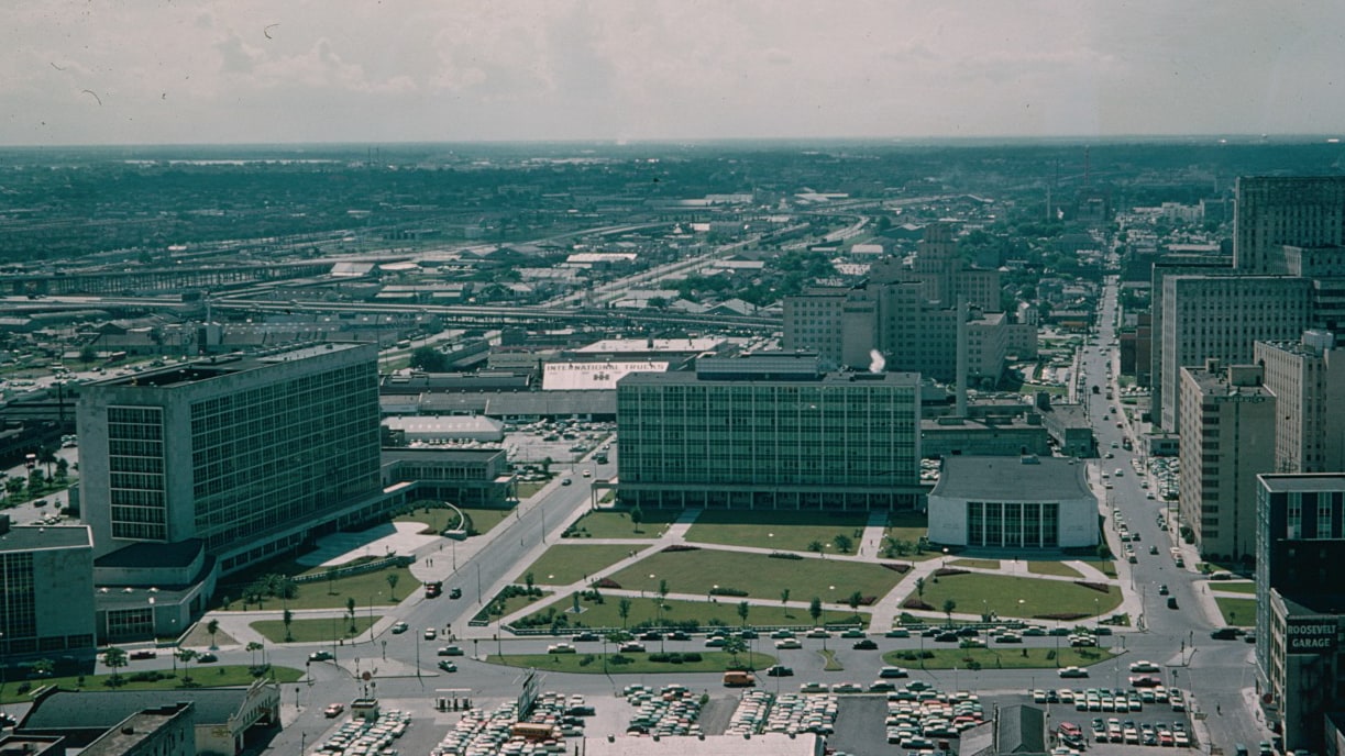
The Historic New Orleans Collection, gift of Eugene C. Major, hnoc.org
2020
Bayou St. John
This archive photograph of Bayou St. John was taken sometime between 1910 and 1930. The before and after view looks down Esplanade Avenue toward City Park and the New Orleans Museum of Art (NOMA). Recorded use of the bayou dates back to Native Americans of the area and was later used at part of a trade route and shipping network. Some residents even lived in houseboats on the bayou but that practice ended in the 1930s, which was around the same time the WPA drained and cleaned the bayou. Over the years the waterway has been slowly sectioned off, and today, many enjoy Bayou St. John recreationally.
1910-1930
2020
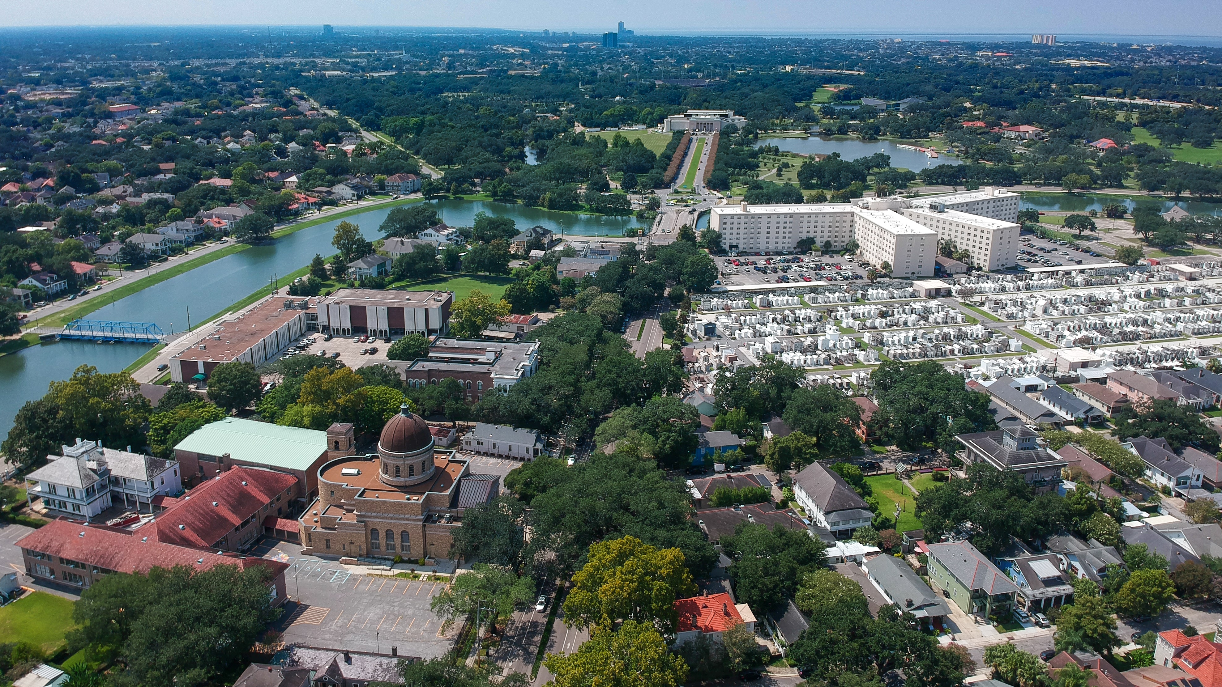
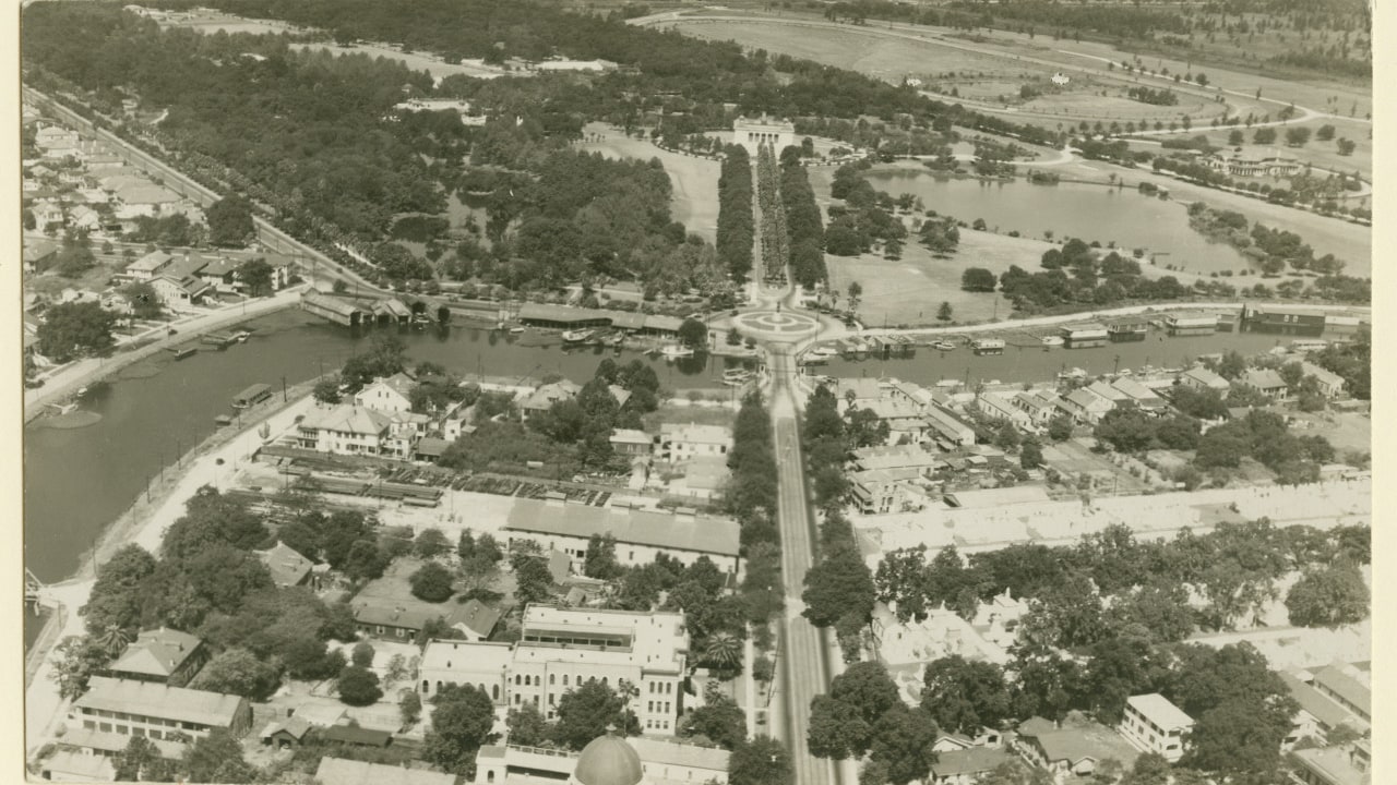
City Park (Roosevelt Mall)
This then-and-now view features City Park’s Roosevelt Mall, New Orleans Museum of Art (NOMA), and Big Lake. Roosevelt Mall was part of WPA projects for City Park and was dedicated by President Roosevelt in 1937. Also seen in the photographs is City Park Stadium, another WPA project at the Park (later renamed Tad Gormley in 1965).
Archive Photo
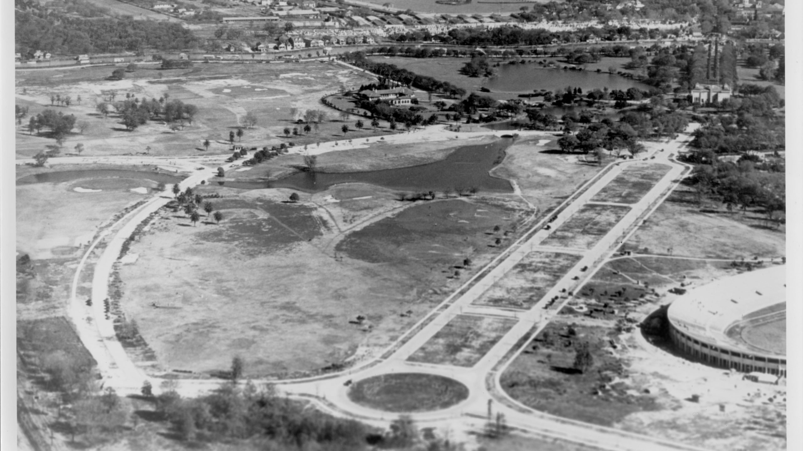
2020
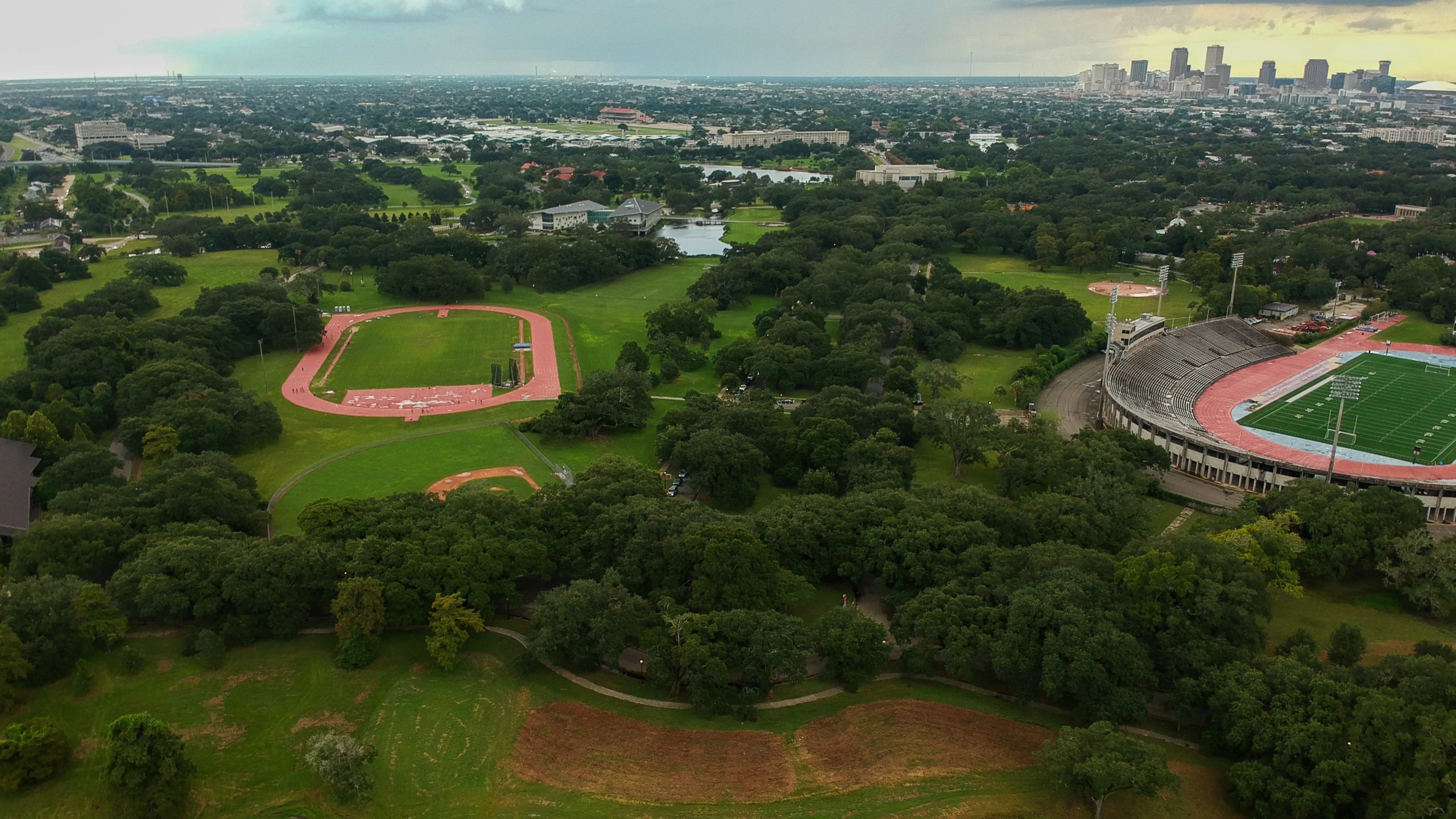
Drone photograph by Megan Mackel for Very Local New Orleans.
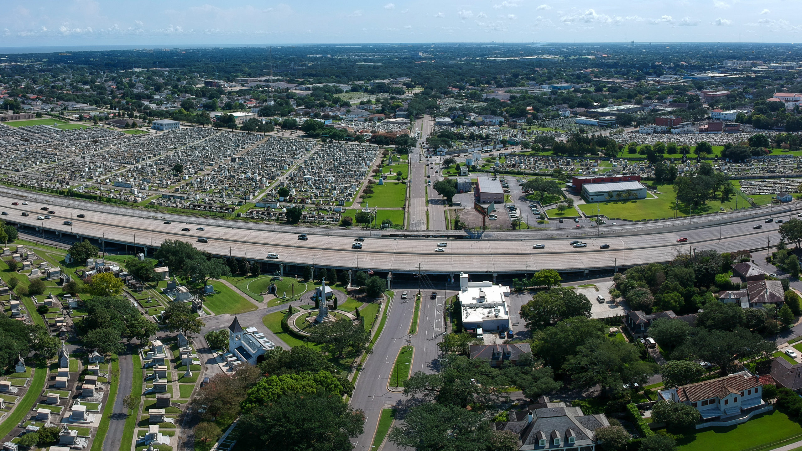
City Park Underpass
Before the interstate, City Park Avenue crossed over a canal, and as seen in this archive photo, ran between Metairie Cemetery and Greenwood Cemetery. The 2020 drone photograph shows City Park Avenue after the installation of the interstate.
Before The Interstate
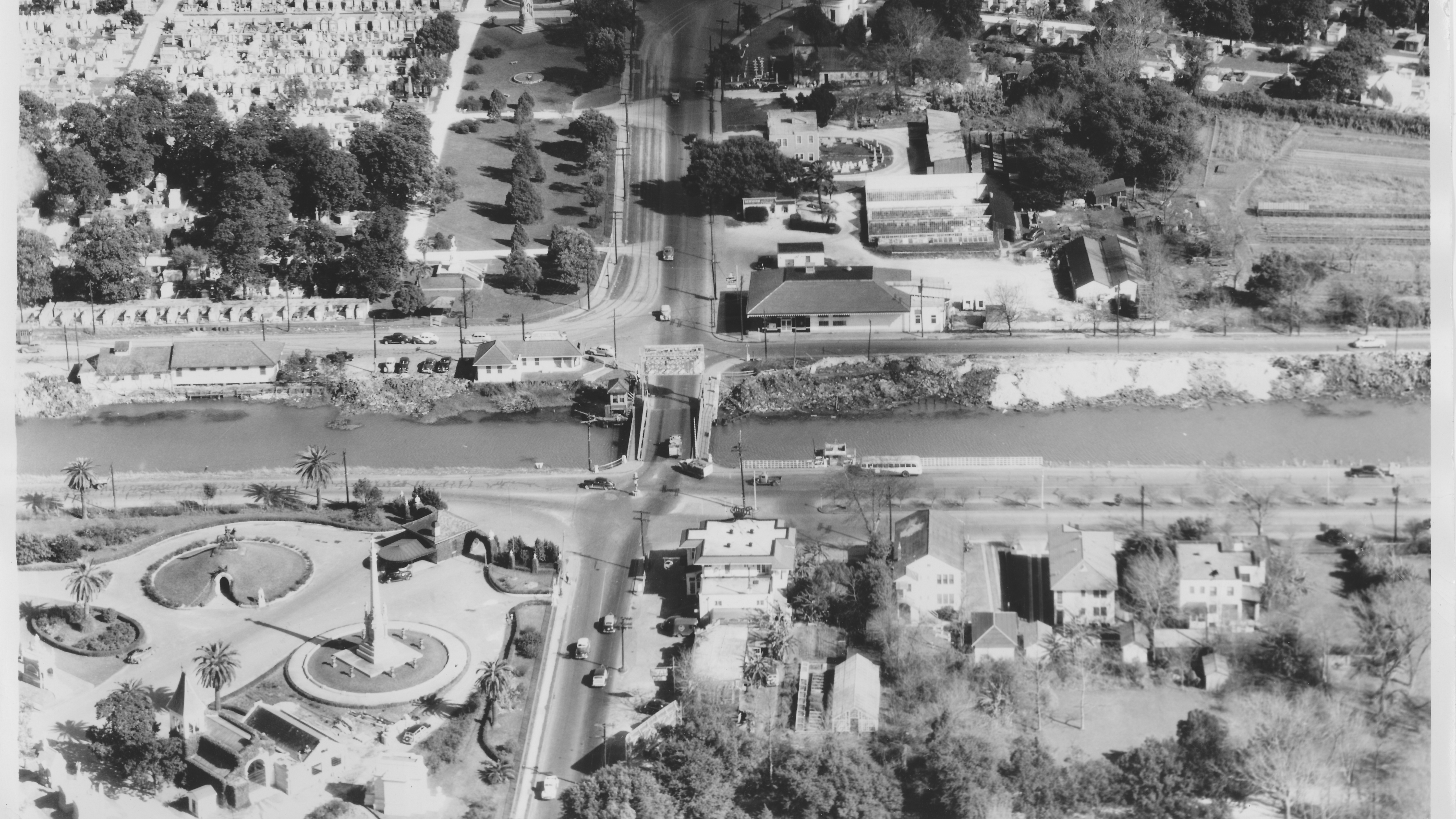
2020
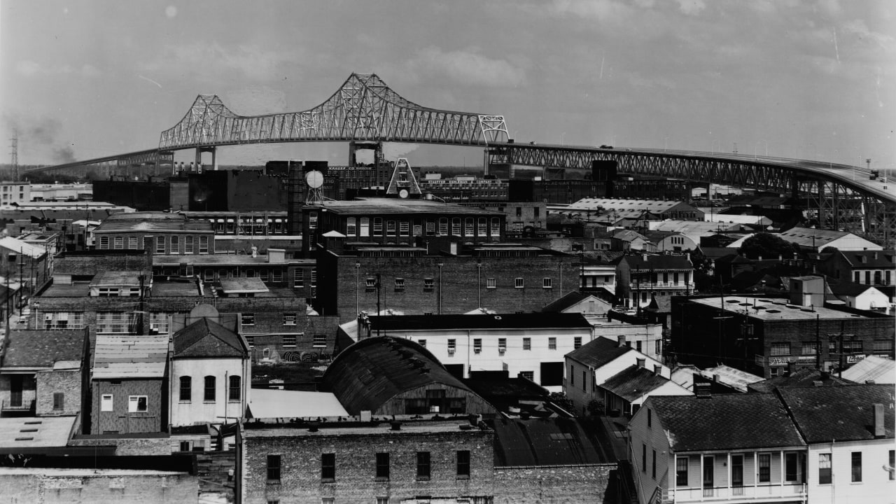
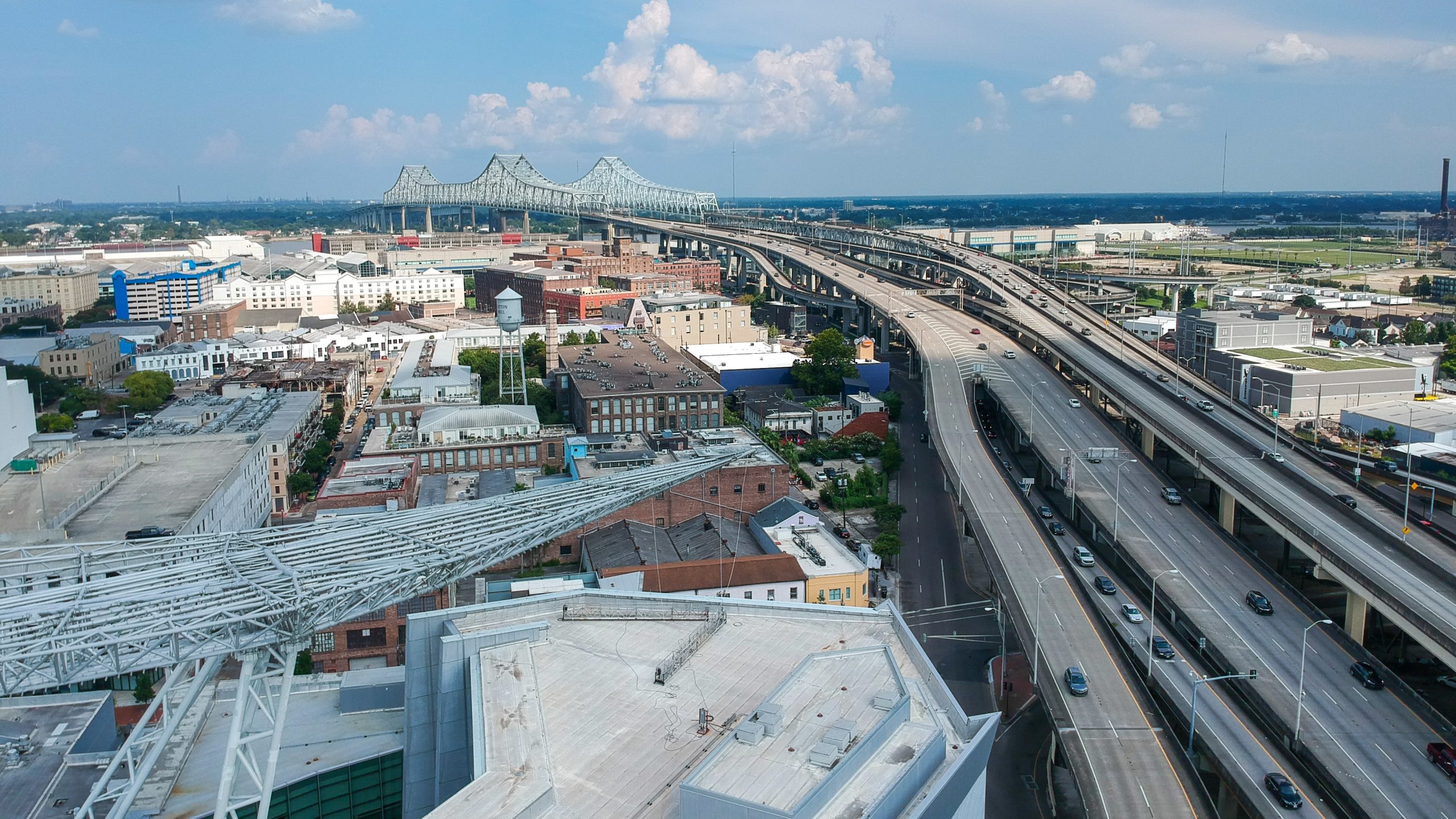
Crescent City Connection
The Crescent City Connection bridge was originally called the Greater New Orleans bridge. The archive photo shows how it looked just after it opened in 1958, with a single span. The second span wouldn’t be constructed until later, eventually opening to traffic in 1988.
1958
2020
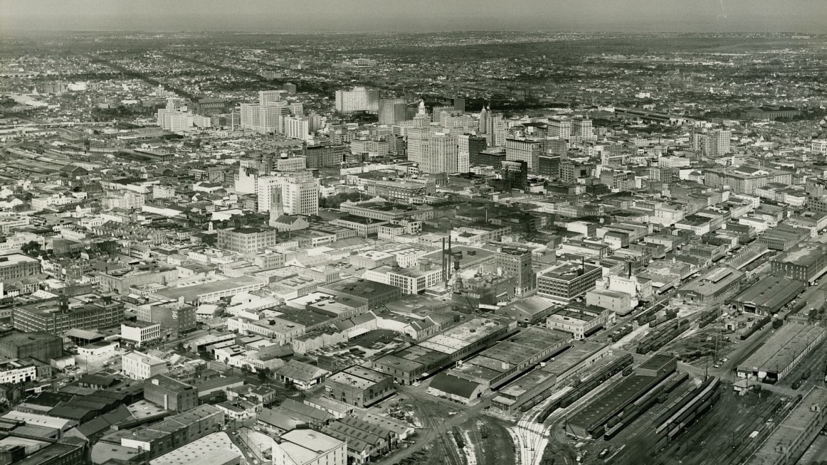
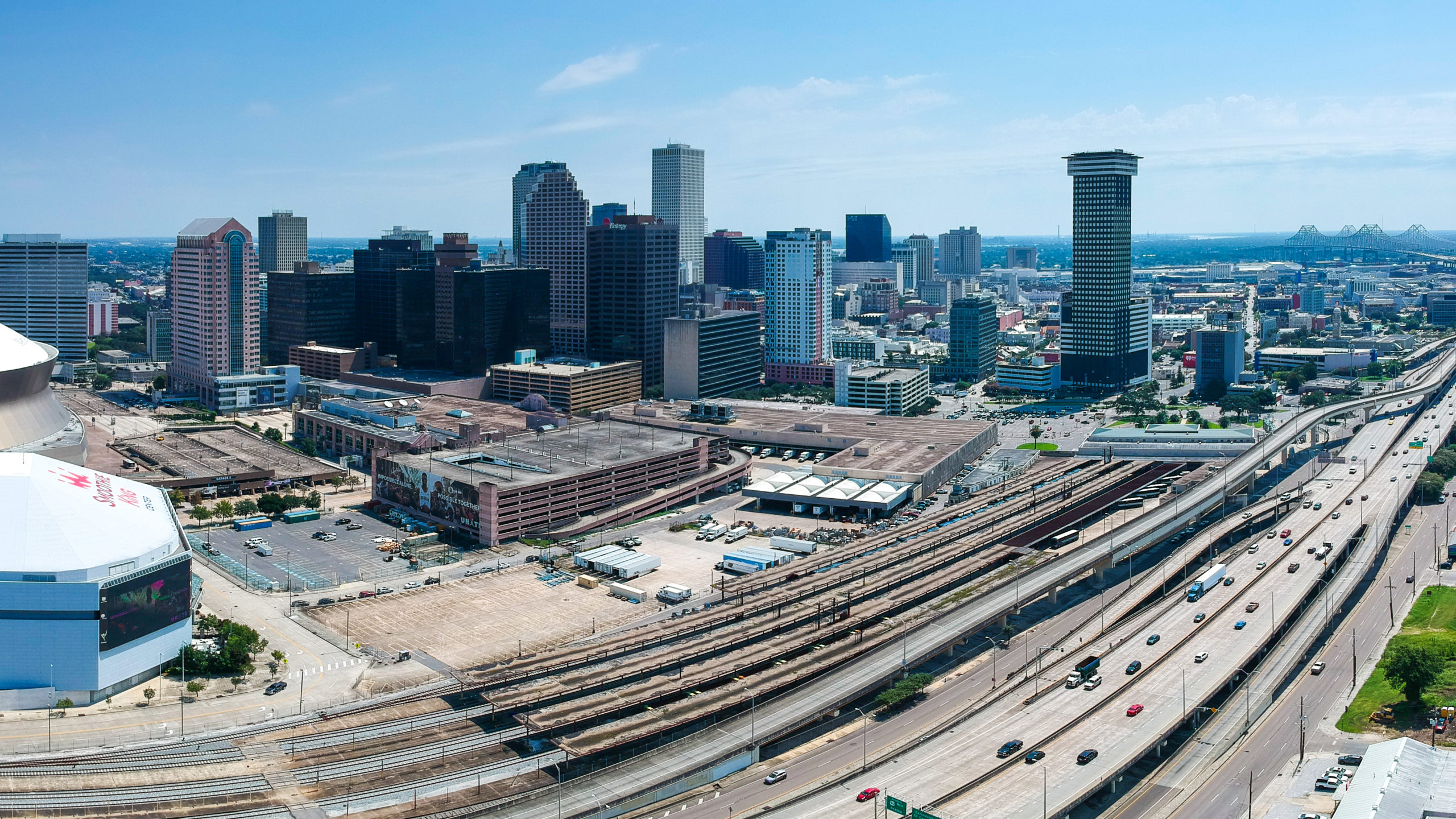
Downtown
Here’s a comparison of what downtown and the CBD looked like in 1954 and as it appears today. The train station is at the bottom right of the images and the archive photo shows the landscape before the interstate. The skyline has changed a lot in the 66 years since this photo was taken. The Hibernia Bank building seen clearly in the archive photo is dwarfed by the skyscrapers seen in the drone photo from 2020.
1954
2020
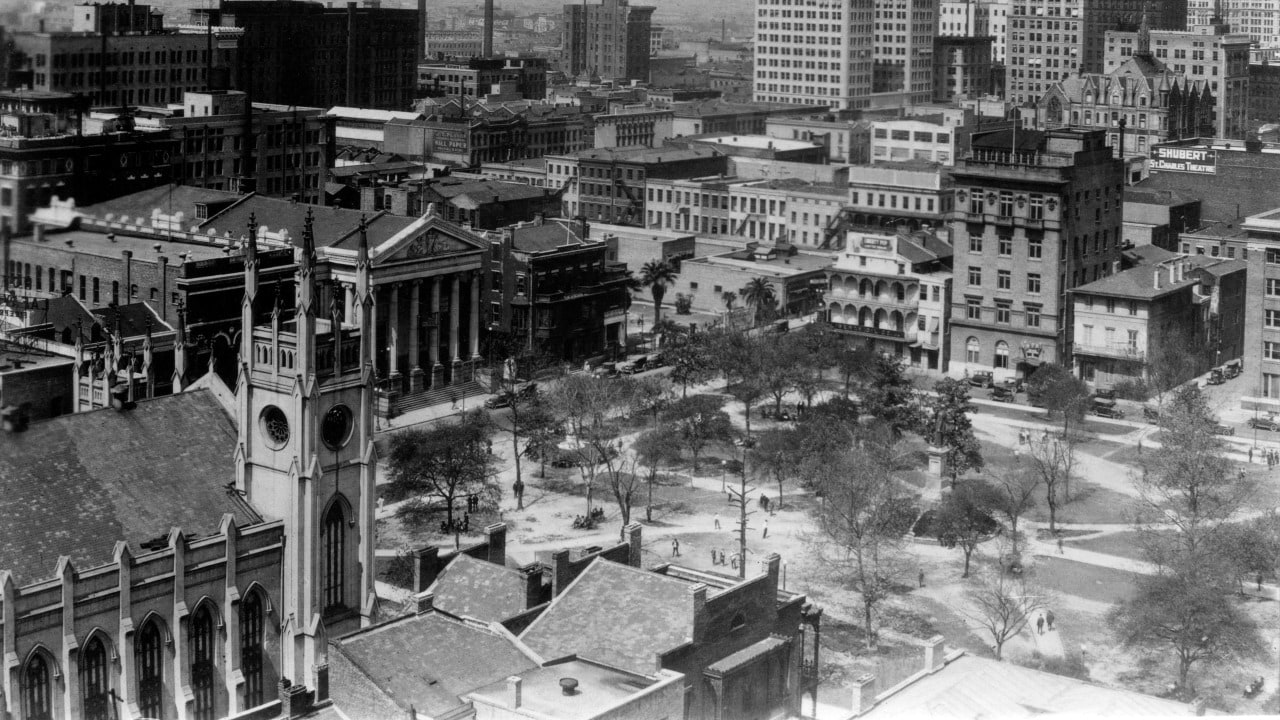
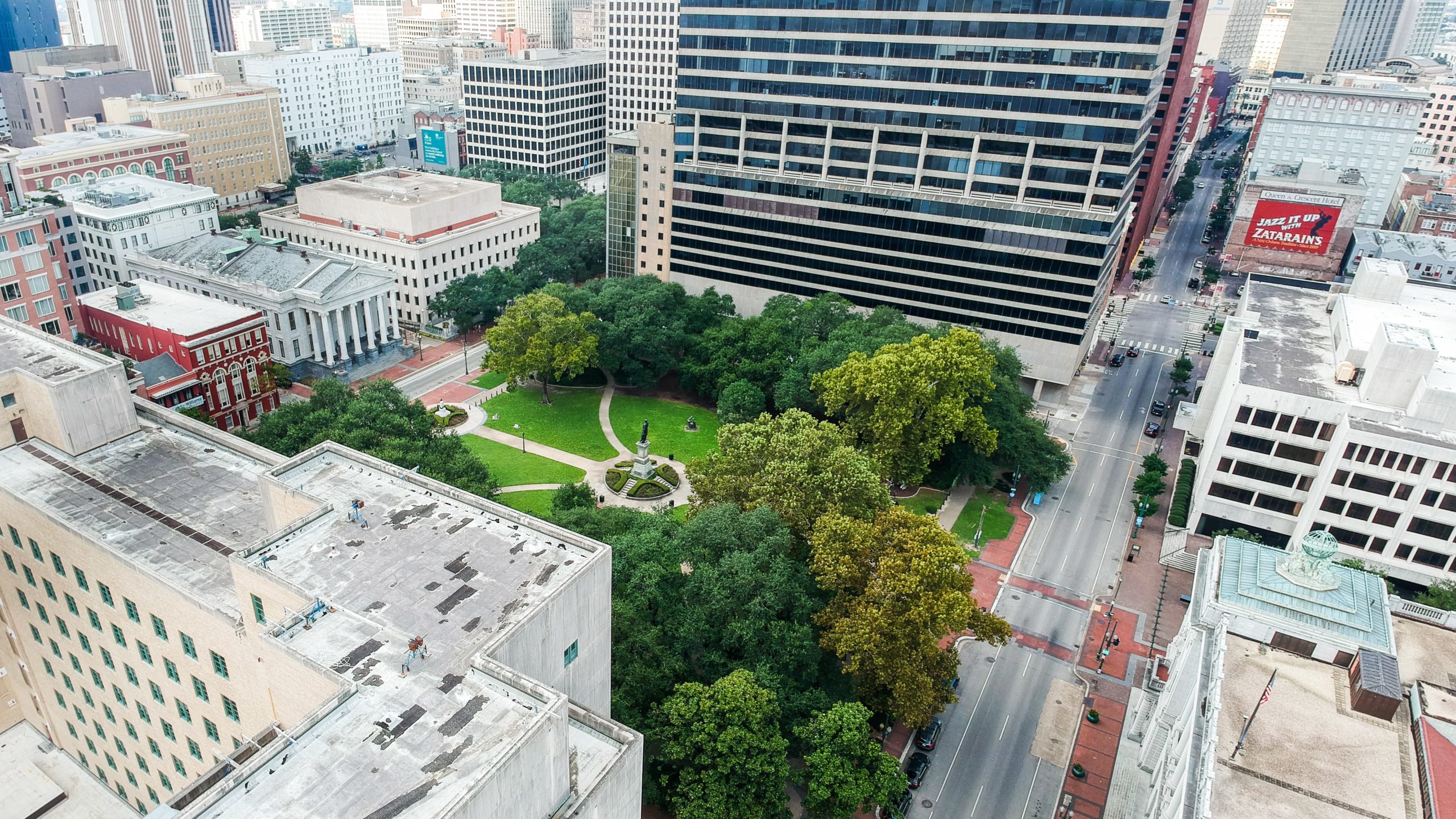
Lafayette Square
This is a view then-and-now of Lafayette Square Park. The park is the second oldest park in New Orleans and dates back to 1788. With a few exceptions, such as Gallier Hall (which was the former City Hall), this 1922 photograph shows some different buildings than what are standing today. In the 1922 view, the First Presbyterian Church of New Orleans can be seen along the southwest side of the park. Today, the same space is occupied by government buildings.
1922
2020
Superdome
Here’s a view from before and after the Superdome was constructed in the Central Business District of New Orleans. The first photo shows the cleared construction site for the Superdome in 1971. Construction for the then-future home of the New Orleans Saints was set at an initial cost of $139 million and was completed in 1975. The current photo shows the Mercedes-Benz Superdome as it is in 2020.
1971
2020
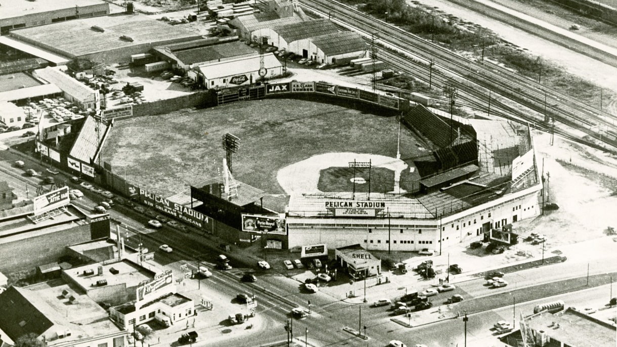
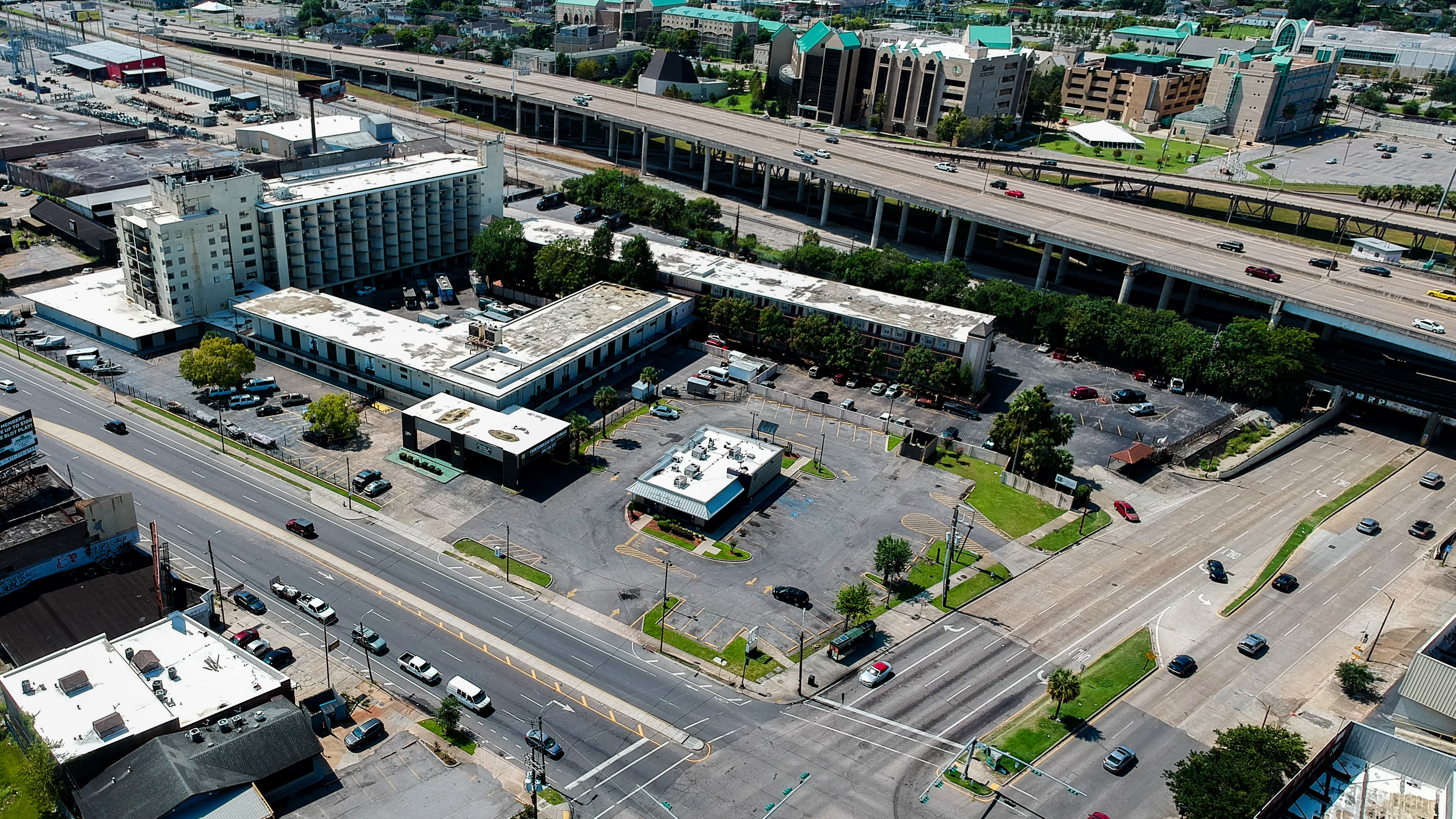
Pelican Stadium
Here is a then-and-now view of Pelican Stadium which was torn down in 1957. The baseball stadium, shown here in 1955 and originally known as Heinemann Park, was used by the New Orleans Pelicans baseball team, the New Orleans Black Pelicans and New Orleans Creoles (the New Orleans Negro league baseball teams) and lay home to spring training for the New York Yankees. Such greats as Joe DiMaggio, Babe Ruth, Lou Gehrig, Jackie Robinson, and Shoeless Joe Jackson all passed through its gates. Today, the same intersection of Tulane Avenue and South Carrollton Avenue looks very different with a Burger King and some apartments where the stadium once stood.
1955
2020
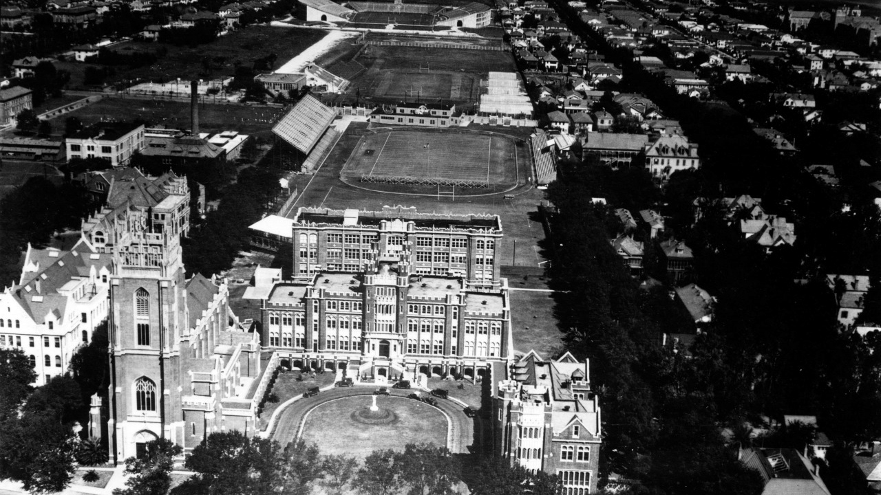
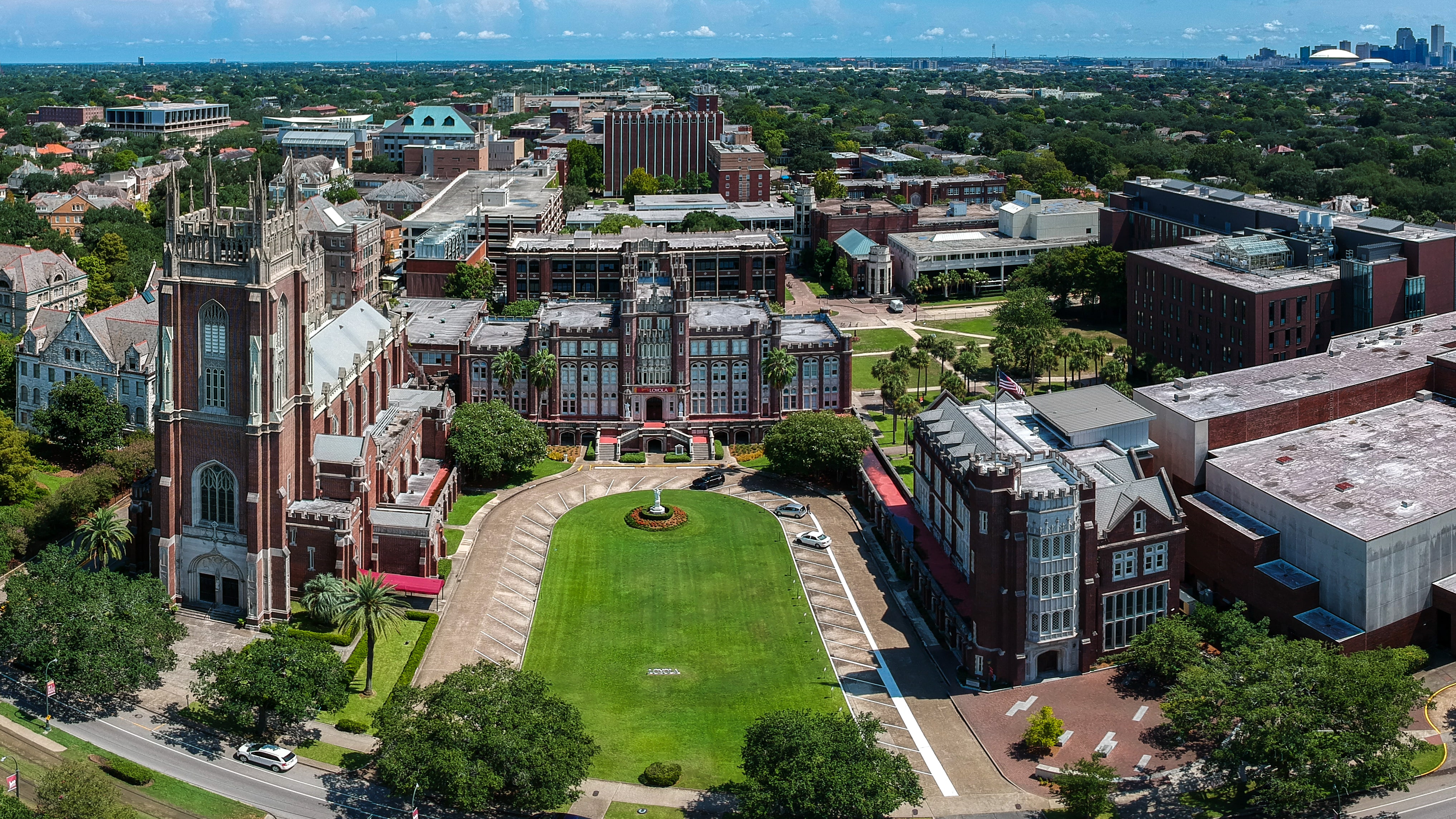
Loyola University
These photos feature Loyola University on St. Charles Ave. The archive photo shows the stadiums behind Marquette Hall as they were sometime between 1926 and 1928. According to Lenny Vanglider of Crescent City Sports, the field directly behind the school is Loyola University Stadium, followed by Tulane’s home field (used before to Tulane Stadium being built), and the one at the top of the photograph is Tulane Stadium.
1926/1928
2020
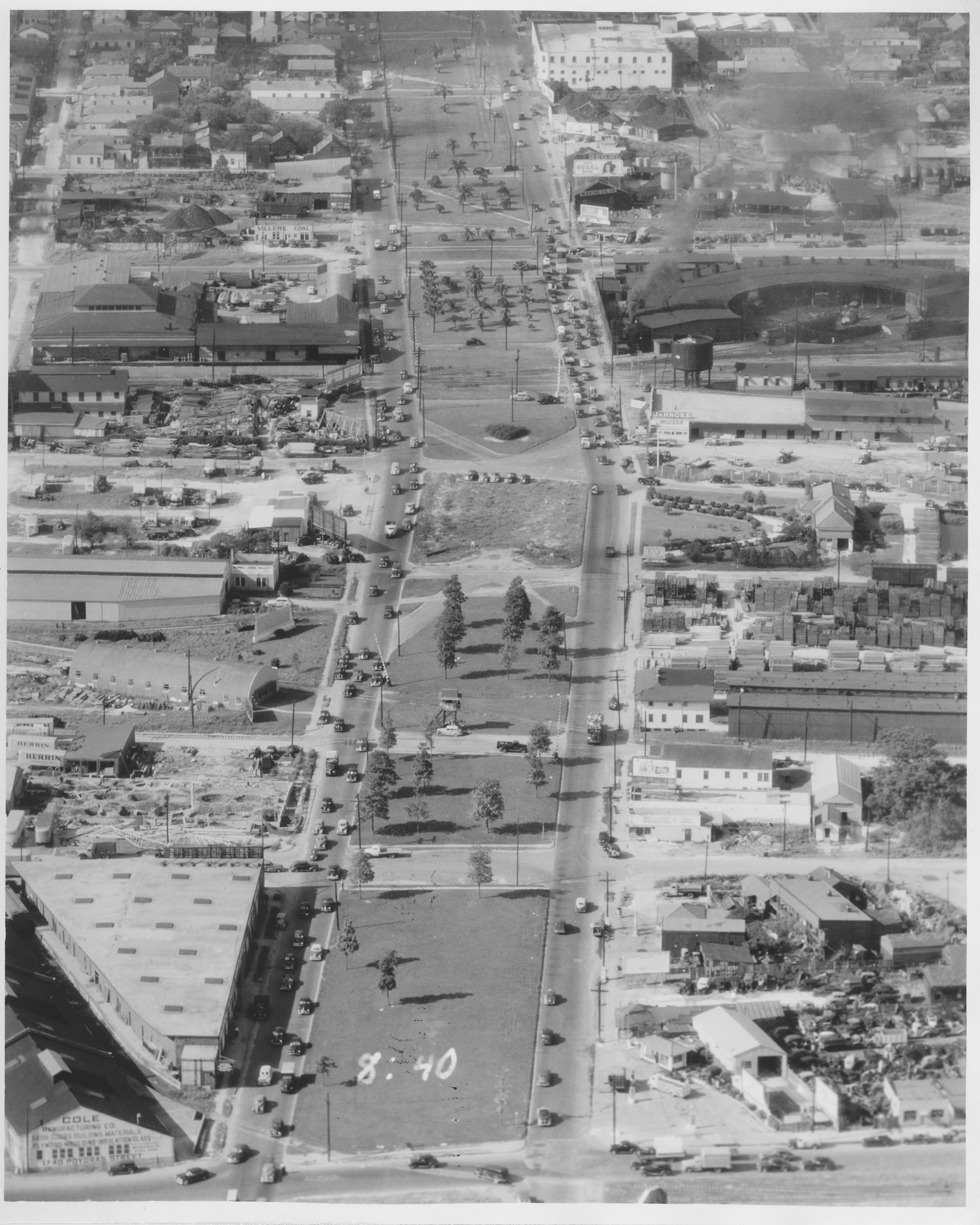
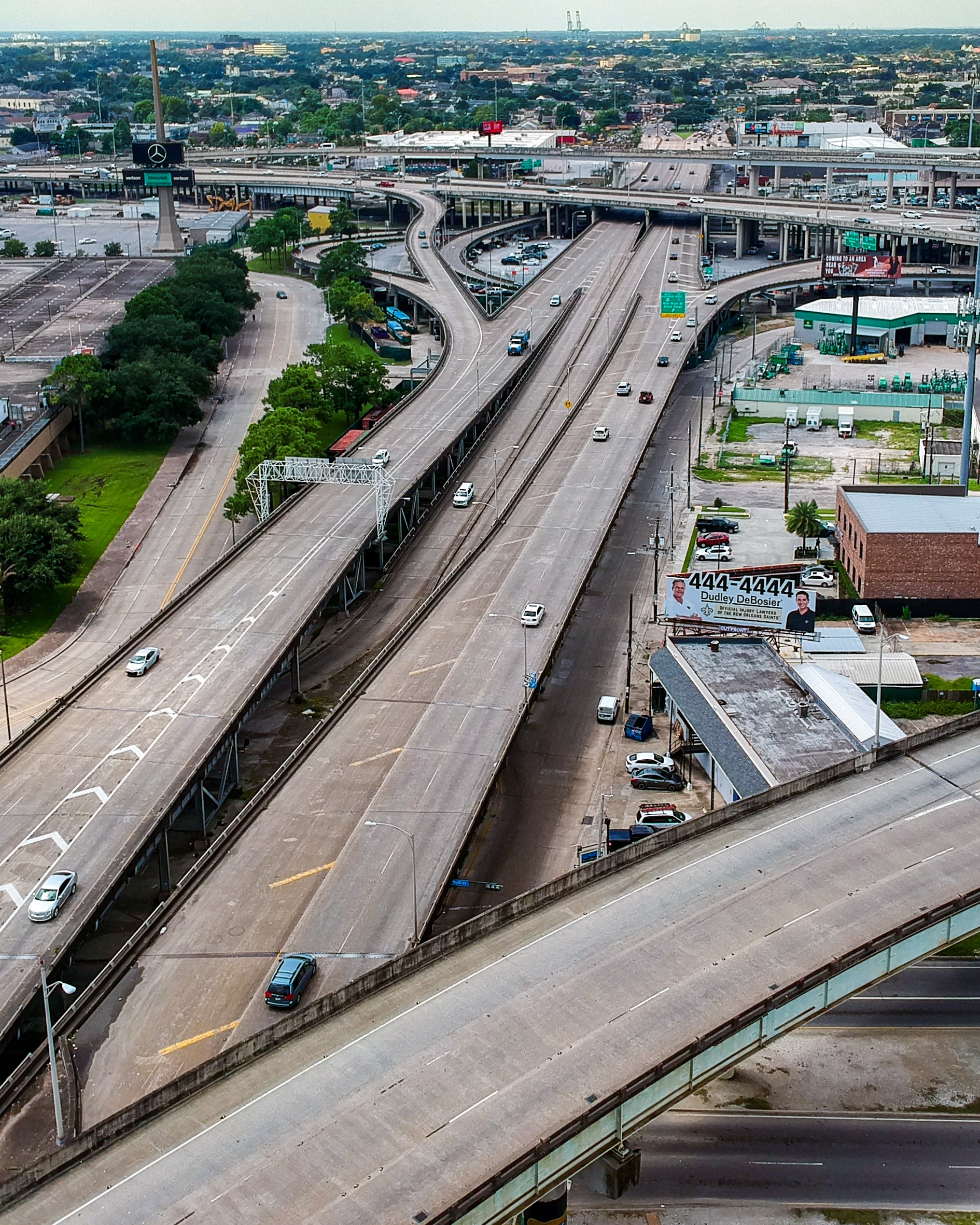
South Claiborne Avenue
Here is a before and after view of South Claiborne Avenue and the interstate that cut through the city and the neighborhoods beginning in the 1960s. For the roadway to be made, 155 individual properties were acquired by the city and 200 oak trees had to be removed, according to a 2016 WWNO report.
Before The Interstate
2020
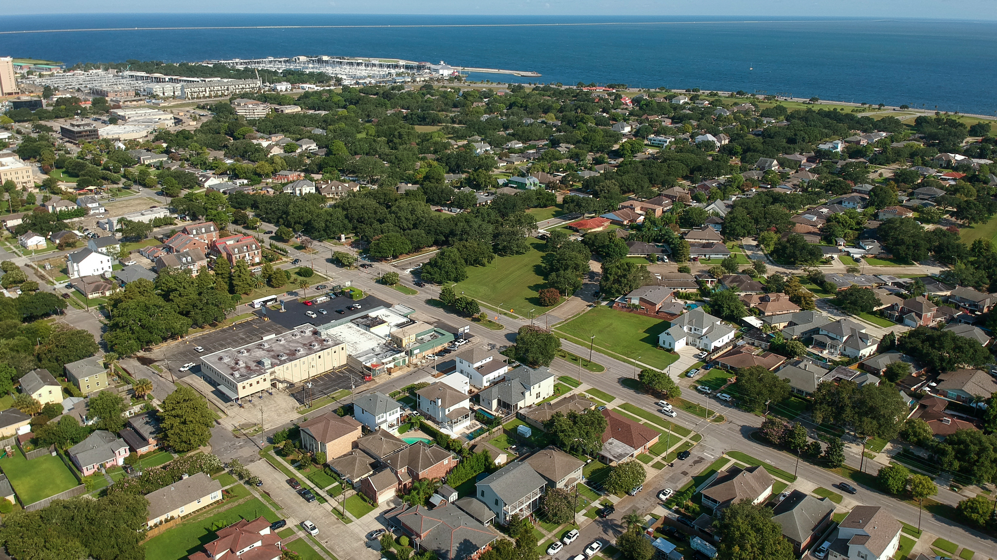
West End
This is a comparative look back toward West End in 1955. The main road running parallel to the lake is Robert E Lee Boulevard intersecting with Canal Boulevard. The archive photo shows an early look at the Lake Shore — Lake Vista neighborhood with the Causeway bridge still under construction.
1955
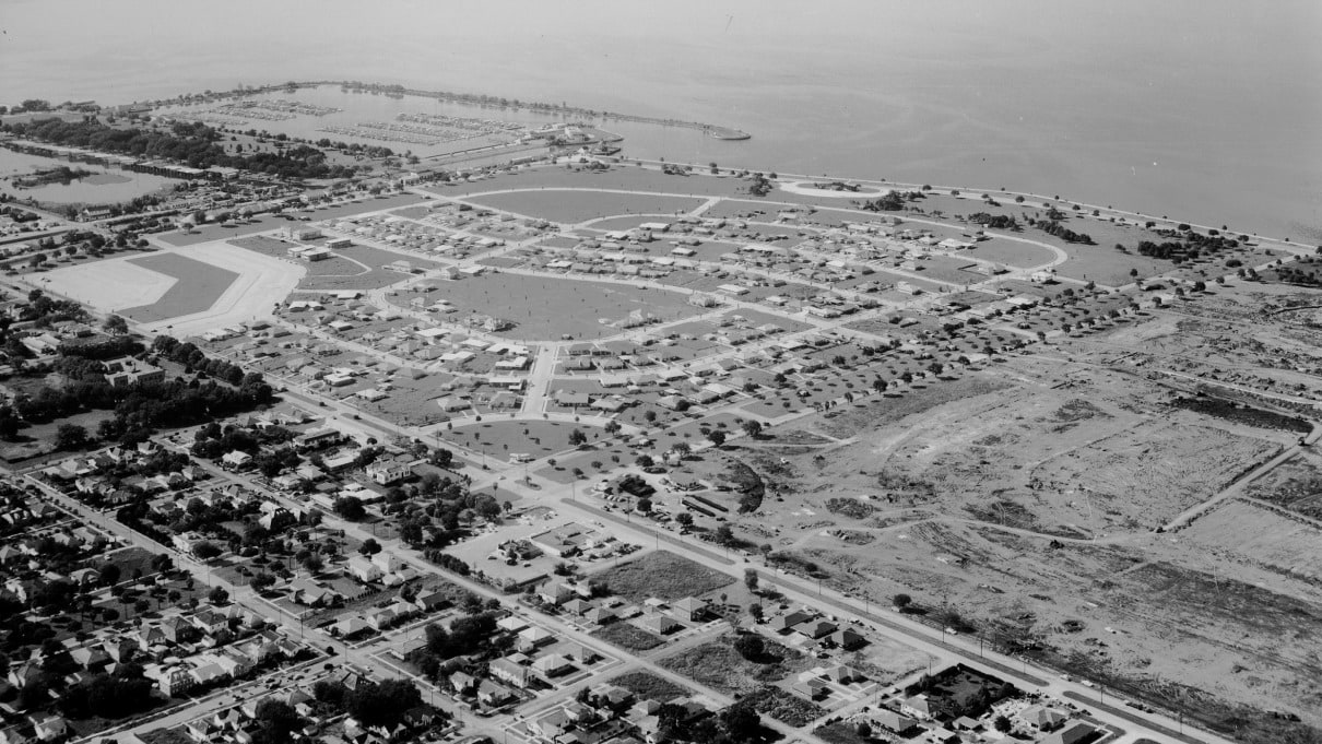
2020